http://geosim.cs.vt.edu/mmap00s.gif
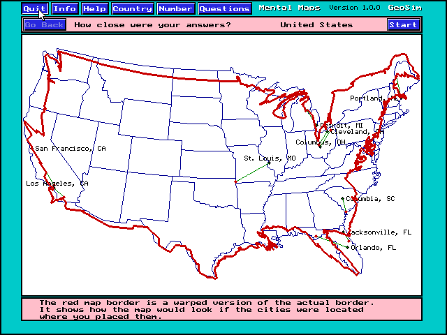
This is a mental map of a students perception of the borders of the United States. Outlined in red is the students mental map positioned over the actual border. It is taken from a mental map program that allows students to test their knowledge of cities, borders, population, and so on.
No comments:
Post a Comment